Pilgrim / Voyageur / Stalker Map

Interloper / Misery Map
Interloper and Misery strip away safety nets. This map is for route planning, rope management, and avoiding assumptions that worked on lower difficulties.
Welcome to the Valley of Misery
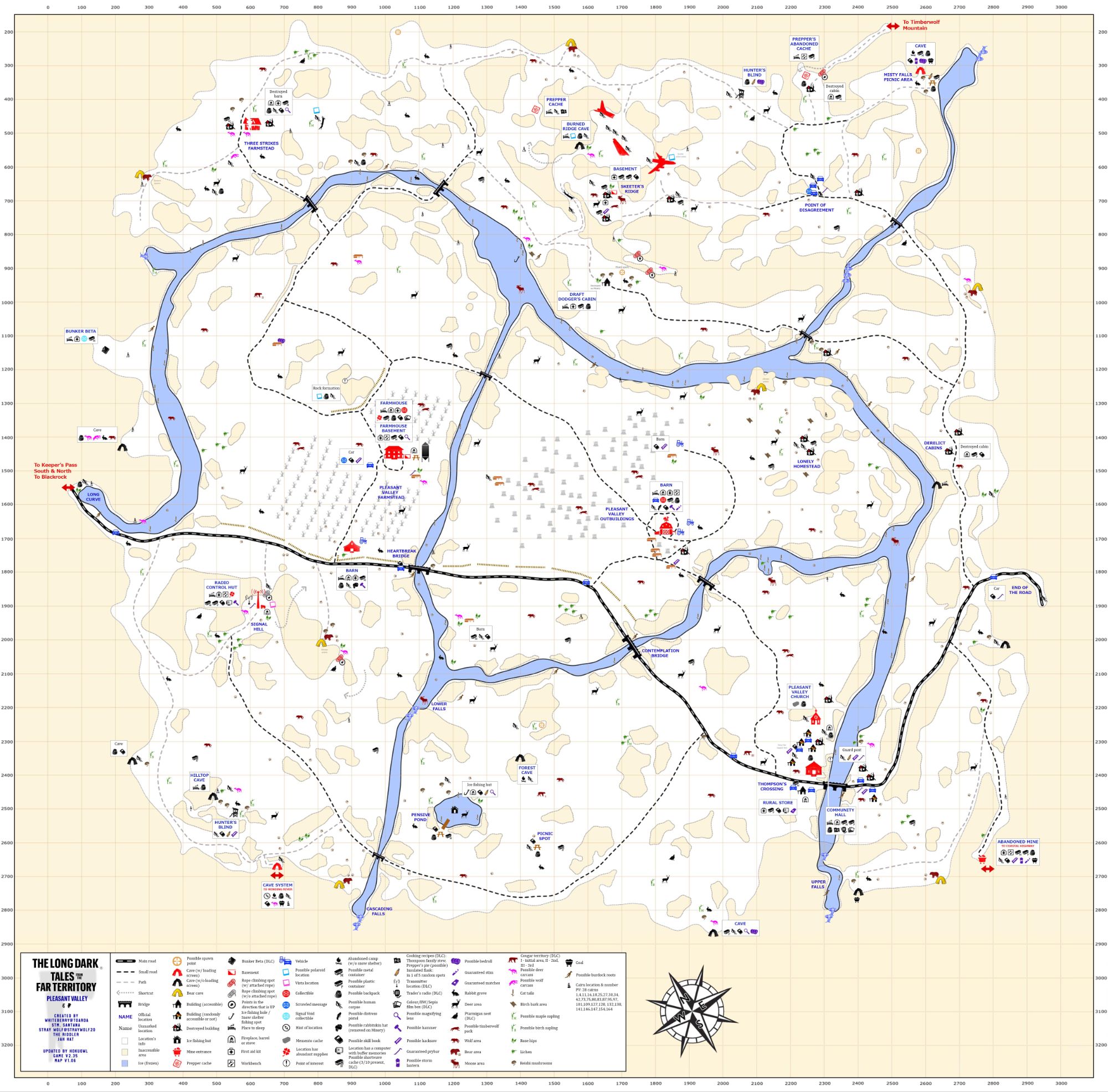
Pleasant Valley earns its name through contrast. Wide farmland. Rolling hills. Open sky. It looks calm until the weather decides otherwise.
Blizzards define this region more than terrain or wildlife ever could. Whiteouts arrive without ceremony, flattening visibility into a wall of snow and wind. Distances that felt manageable minutes earlier become dangerous guesses. Navigation here relies less on landmarks and more on memory.
The open terrain amplifies exposure. There’s little natural cover between structures, and wind crosses fields without obstruction. Bears patrol certain approach routes, and wolves move confidently across the farmland, but it’s usually the weather that ends runs here — not the wildlife.
The Farmstead stands as the region’s anchor. Central positioning, interior warmth, storage space, and room to operate make it one of the more practical long-term bases in Great Bear. It allows you to stage supply runs with some structure behind you.
Signal Hill offers elevation and strong visibility when conditions are clear, but that advantage disappears the moment a storm rolls in. Barns scattered across the valley provide temporary shelter, though reaching them often requires committing to open ground longer than feels comfortable.
Pleasant Valley doesn’t feel aggressive. It feels indifferent. Plan your routes carefully. Leave early in clear weather. And assume that every long crossing may need a backup plan before you take the first step.
It isn’t the terrain that breaks you here. It’s the wind.

